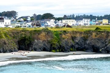
Pacifica is the Bay Area’s closest true coast town — about 15 miles south of San Francisco, where Highway 1 drops onto a foggy, cliff-edged shoreline. It’s not one destination so much as six miles of them: a beginner surf beach in the middle of town, a trail along a decommissioned stretch of Highway 1, a bootlegger’s headland run by the National Park Service, and a 1,140-foot fishing pier. This Pacifica travel guide is for first-time visitors and city day-trippers: the best things to do, one closure to know about, and a simple 1-day itinerary. Hours, closures, and fees change — confirm details on the official pages linked below.
At a Glance: Pacifica in Brief
- Where: San Mateo County, ~15 miles south of San Francisco — about 20 to 30 minutes by car on Highway 1
- Don’t miss: Devil’s Slide Trail, Pacifica State Beach (Linda Mar), and Mori Point
- Heads up: The Pacifica Municipal Pier has been closed since June 4, 2026 for emergency repairs — check the city’s pier page before planning around it
- Getting there: Drive Highway 1, or ride SamTrans Route 110 from Daly City BART to Linda Mar Park & Ride; it runs daily
- Best time: Fall for the clearest skies; winter brings gray whales close to shore
- Pair it with: Our San Francisco travel guide for the city side of the trip
Pacifica Travel Guide: Top Things to Do
Walk or Bike Devil’s Slide Trail
The most famous piece of this Pacifica travel guide is a road that gave up. Devil’s Slide Trail is the old Highway 1 — the section plagued by landslides for decades — converted into a paved multi-use path when traffic moved into the Tom Lantos Tunnels in 2013, and opened as a trail in 2014. The 2.6-mile round trip has separate hiker and bike lanes, benches, overlooks with observation scopes, restrooms, and drinking fountains at both ends.
Parking is tight (13 spots north, 24 south — the north lot only works driving southbound), so arrive early or ride SamTrans Route 17 on busy weekends. Bring layers, watch for whales in winter and spring, and note leashed dogs are welcome. Just south sits Gray Whale Cove State Beach, an 800-foot beach below a steep stairway. More history and wildlife details are on the San Mateo County Parks Foundation’s Devil’s Slide Trail page.
Surf (or Watch) at Pacifica State Beach
Pacifica State Beach is the town’s center of gravity — the three-quarter-mile crescent locals call Linda Mar Beach. It’s one of the best-known beginner surf beaches near San Francisco, with surf schools right on the sand, and it hosts the World Dog Surfing Championships — the beach half of this Pacifica travel guide in a single stop. Per the official California State Parks page: day-use only, closes at sundown, parking fees apply (the State Parks annual pass isn’t accepted), and dogs are allowed on leash. It also shelters the threatened western snowy plover — respect posted nesting areas.
Hike Mori Point’s Bootlegger Trails
South of the pier, Mori Point is a 110-acre headland run by Golden Gate National Recreation Area — and the best story in this Pacifica travel guide. Italian immigrant Stefano Mori farmed here in the 1890s; during Prohibition his son Jack ran a bootlegging operation from the family inn until federal agents arrested him in 1923 and seized 24,000 cases of whiskey. The roadhouse survived as a dance hall until 1965, burned in 1966, and the site became National Park Service land in 2004. The NPS tells the full story on its Mori Point history page.
Today the Bootlegger’s Steps climb the bluff to 180-degree ocean views, the accessible Old Mori Trail makes a 2.5-mile round trip to a whale-watching overlook, and the graffiti-covered WWII bunkers at the summit are a Pacifica landmark. No entrance fee; leashed dogs are welcome. Spring wildflowers are the bonus.
Check the Pacifica Pier — Closed for Repairs
A note every current Pacifica travel guide needs: the Pacifica Municipal Pier — the 1,140-foot L-shaped Rev. Herschell Harkins Memorial Pier built in 1973 — is closed as of June 4, 2026 for emergency investigation and stabilization, with the adjacent beach area closed as well. When it reopens, it’s one of the Bay Area’s top public fishing piers: no admission charge, no fishing license required, free parking nearby, fish cleaning stations, and winter Dungeness crabbing that usually starts the first Saturday of November. Normal hours are 4 a.m. to 10 p.m., though high surf can close it with little notice. Confirm the current status on the City of Pacifica’s pier page before you plan a crabbing trip.
Art, Rockaway Beach & the Coast South of Town
South of downtown, the arts-and-beaches half of this Pacifica travel guide unfolds along Rockaway Beach Avenue and the headlands:
- Sanchez Art Center: At 1220 Linda Mar Blvd, about a mile east of Highway 1, this nonprofit’s mission is to “create community through art” — free exhibitions in three galleries, arts education, and studio space for Bay Area artists. Galleries are open Friday through Sunday, 1 to 5 p.m., during exhibitions. Check the exhibition schedule before you go.
- Rockaway Beach: The quieter sibling south of Linda Mar — surfing, leashed dogs, restrooms and showers, and the Coastal Trail running north along the bluffs toward Rockaway Point and Pedro Point. Rockaway Beach Avenue has the best midday food options on this stretch of coast.
- Sweeney Ridge: The GGNRA’s Sweeney Ridge trailheads lead to a 1,200-foot summit with views of both the Pacific and San Francisco Bay — and it’s the National Historic Landmark where the Portolá expedition first sighted the bay in 1769. Leashed dogs are welcome.
- Devil’s Slide Ride: Pacifica hosts the Devil’s Slide Ride, an annual charity cycling event whose routes run Highway 1 through Devil’s Slide, raising funds for programs supporting people with developmental disabilities in San Mateo County. It’s been intermittent in recent years — check current status before planning around it.
Pacifica Travel Guide: 1-Day Itinerary
This is the essential one-day version of this Pacifica travel guide — all three anchors, zero backtracking.
- Morning (8:30–11:00 a.m.): Devil’s Slide Trail by 9 a.m. — the 2.6-mile round trip, with whale, seal, and falcon watching
- Midday (11:00 a.m.–1:00 p.m.): Pacifica State Beach walk and lunch around Linda Mar; add the Sanchez Art Center on weekend afternoons
- Afternoon (1:30–4:30 p.m.): Mori Point — Bootlegger’s Steps, the headland loop, and the graffiti bunkers with the view north toward San Francisco
- Evening: Dinner along Rockaway Beach Avenue, or a Highway 1 drive south down the San Mateo coast
- With two days: Add Sweeney Ridge, or pair with our Sausalito travel guide for a classic Bay Area coastal weekend
Practical Info: Parking, Dogs, Fees & Transit
- Parking: The main friction point in any Pacifica travel guide. Devil’s Slide’s two lots fill early — go on a weekday or ride SamTrans. Linda Mar charges for its main lot (the State Parks annual pass isn’t accepted); free street parking near the pier area usually works with a short walk.
- Dogs: Leashed dogs are allowed at Linda Mar, on Devil’s Slide Trail, and throughout Mori Point and the GGNRA lands. Dogs are not allowed on the pier (except service dogs), and leash rules are enforced.
- Fees: Devil’s Slide Trail and Mori Point are free. Pacifica State Beach charges for parking, not entry. Check current rates with local surf schools for lessons or rentals.
- Transit: SamTrans Route 110 runs daily between Daly City BART and the Linda Mar Park & Ride. Route 112 connects Sharp Park to Colma BART, and Route 17 serves the Devil’s Slide trailheads on weekends. Check current routes on SamTrans.
- Closures: The pier is closed as of June 2026. Linda Mar’s lot hours are 5 a.m. to 10:30 p.m. in daylight saving time, 5 a.m. to 7 p.m. in fall and winter — verify with the city.
Pacifica Travel Guide FAQ
Is the Pacifica Pier open? As of this Pacifica travel guide’s research (October 2026), no — closed since June 4, 2026 for emergency investigation and stabilization, with the adjacent beach area closed as well. The city has awarded an emergency repair contract, but no reopening date has been announced. Check the city’s pier page for the latest status.
Can you surf at Pacifica as a beginner? Yes — Linda Mar is one of the most beginner-friendly surf beaches near San Francisco, with lessons and rentals right on the beach: a signature experience in this Pacifica travel guide. Expect cold water (wetsuits year-round); weekday mornings are least crowded.
Where do I park for Devil’s Slide Trail? Two small free lots on either side of the Tom Lantos Tunnels — about 13 spots north (accessible only driving southbound) and 24 south. Both fill early on sunny weekends; Highway 1 shoulders are not legal parking. SamTrans Route 17 stops at the trailheads.
How do I get to Pacifica without a car? SamTrans Route 110 connects Daly City BART to the Linda Mar Park & Ride every day. From there, the beach, shops, and Sanchez Art Center are walkable.
How many days do you need in Pacifica? One full day covers Devil’s Slide Trail, Linda Mar, and Mori Point — the three anchors of this Pacifica travel guide. Two days adds Sweeney Ridge and Rockaway Beach.
Keep Exploring California
Pacifica is the easiest way to put real ocean into a Bay Area trip — big cliffs, working surf beaches, and GGNRA trails without the drive to the redwoods. When you’re ready to keep going, this Pacifica travel guide hands off naturally to our Northern California coast road trip guide for the Highway 1 drive south through Half Moon Bay and beyond.