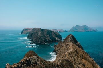
Six thousand acres of wind-scoured bluffs, honeycomb rock, and miniature forest sit on one of the wildest stretches of the Sonoma Coast, and this Salt Point State Park guide is built for first-timers who want the highlights without missing the strange details that make the park famous. The park holds more than 20 miles of trails and six miles of rugged coastline on Highway 1, about 20 miles north of Jenner and 90 miles north of San Francisco.
At a Glance
The short version of this Salt Point State Park guide:
- Where: 25050 Highway 1, Jenner, CA 95450, on the Sonoma Coast
- Getting there: Highway 1 north from Jenner; winding road, allow extra time
- Best for: Tidepooling, tafoni, pygmy forest, bluff hiking, camping, whale watching
- Trails: More than 20 miles, including a 3.8-mile pygmy forest loop
- Fees: Day-use parking fee at staffed lots; check current rates on the California State Parks page for Salt Point
- Dogs: On leash in campgrounds and paved areas; prohibited on hiking trails and beaches
- Services: Basic only — restrooms, picnic areas, no hookups; check the park page for closures
Salt Point State Park Guide: Tidepooling at Gerstle Cove
Gerstle Cove is the natural starting point for this Salt Point State Park guide, because it holds the park’s best tide pools and its most sheltered water. The cove sits just below the day-use parking area. At low tide, the pools hold sea stars, anemones, hermit crabs, chitons, and small fish. Time your visit for the lowest tide.
The cove is protected as the Gerstle Cove State Marine Reserve, a no-take zone since 1971 where all marine life is completely protected, and one of California’s first underwater parks. Look without touching, collecting, or turning over rocks. State Parks’ tidepool tips cover the basics: check the tide chart, wear grippy closed-toe shoes, and step only on bare rock.
Never turn your back on the ocean, even at low tide — sneaker waves can surge higher than the waves before them with no warning. The water is cold, the rocks are slippery with algae, and the surf is dangerous for swimming or wading. Leave the rocks well before the tide turns, and if a high surf advisory is in effect, enjoy the cove from the bluff-top trail instead.
Salt Point State Park Guide: Tafoni and the Sandstone Coast
The rock itself is the second reason to visit, and this Salt Point State Park guide treats the tafoni as a main attraction rather than a curiosity on the way to somewhere else. Tafoni — from an Italian word for cavern — is the honeycomb pattern carved into the park’s sandstone by salt crystals, wind, and waves. The sandstone hardens in some places and softens in others, leaving a lacework of pits, ribs, and hollows that looks carved by hand. Sonoma County Tourism’s natural wonders guide lists the tafoni among the county’s most unusual sights.
The best tafoni sit near the ocean’s edge at Gerstle Cove and Fisk Mill Cove. The park is named for the salt crystals in the rock’s cracks; the same sandstone was quarried here in the mid-1800s for San Francisco buildings. Drill holes and iron eyebolts from the old quarry days are still visible in the rock at Gerstle Cove. Stay back from cliff edges — wet sandstone is slick underfoot.
Hiking the Bluffs and Stump Beach
The bluff-top trails are the easiest way to see the park’s full range in a single walk, and this Salt Point State Park guide recommends starting with the Salt Point Trail from the Gerstle Cove day-use area. A short accessible loop of just under half a mile runs along the coastal bluffs from the parking area — the best option for big views without a climb. Longer routes follow the terraces past rocky promontories and kelp-dotted coves.
Stump Beach is the park’s only sandy beach, and it is worth the walk. The Salt Point Trail runs about 3.3 miles out and back to the cove, where a small creek meets a steep-sided pocket of sand between the bluffs. The beach is not for swimming: strong surf and cold water make the whole Sonoma Coast dangerous for entering the water.
The San Andreas Fault runs through the park. Carry layers on every hike — even summer days can turn cool and foggy fast — and bring more water than you expect, since there is no drinking water along the trails.
Salt Point State Park Guide: The Pygmy Forest Trail
The strangest hike in the park is also one of its best, and this Salt Point State Park guide gives the pygmy forest its own section because nothing else on the Sonoma Coast looks like it. At the park’s highest point, around 550 feet, a grove of Mendocino cypress, bishop pine, Bolander pine, and even coast redwood grows only a few feet tall. Some of these trees are more than a century old — fully mature, just miniature. The cause is the soil: highly acidic, nutrient-poor ground with a hardpan layer close to the surface that starves the roots and stunts the growth.
The Pygmy Forest Trail is a 3.8-mile loop that takes about two hours, starting near the Woodside Campground and climbing through mixed evergreen forest and open prairie before reaching the stunted grove. Pair it with the adjacent Kruse Rhododendron State Natural Reserve, which bursts into pink blossom in late April.
Camping at Salt Point: Gerstle Cove and Woodside
This Salt Point State Park guide covers the two campgrounds so you can pick the right one. Gerstle Cove Campground sits on the coastal bluffs above the cove, with 30 family sites that put the sound of the surf right outside the tent. Woodside Campground sits inland among mixed conifers, with 79 sites tucked into the forest. Both have picnic tables, fire rings, food lockers, and restrooms, and both book through ReserveCalifornia six months ahead.
Expect basic sites with no hookups, and check current rates when you book. Gerstle Cove Campground is open year-round. Dogs are welcome on leash in the campgrounds, but they must stay in a vehicle or tent at night and are not allowed on the trails or beaches. Quiet hours are 10 p.m. to 6 a.m., and each site covers one vehicle.
Fishing, Diving, and the Underwater Park
Salt Point holds one of California’s first underwater parks, and this Salt Point State Park guide treats the water as a look-but-don’t-take place unless you know the rules cold. Gerstle Cove is a no-take reserve where fishing and collecting are prohibited. The surrounding Salt Point State Marine Conservation Area allows only the recreational take of finfish. The state publishes the full boundaries and take rules on its marine protected areas page — anyone fishing or diving should read that page and check current California Department of Fish and Wildlife regulations first.
Outside the reserve, surf fishing and scuba diving in the kelp beds are popular. A valid California fishing license is required for any fishing. Know which zone you are in before you take anything — when in doubt, take nothing.
When to Visit and What to Pack
There is no bad season at Salt Point, but this Salt Point State Park guide leans toward fall for first-timers: the fog is lighter, the trails are drier, and the light on the sandstone is at its best. Winter brings dramatic surf and migrating gray whales, along with rain and possible Highway 1 delays. Spring brings wildflowers, the rhododendron bloom next door, and summer brings morning fog that usually burns off by midday.
Pack layers, a windproof jacket, grippy closed-toe shoes, sun protection, and extra water. There are no food services in the park, so bring lunch and snacks, and carry out everything you bring in. Coming from the south, the Bodega Bay travel guide is the natural next stop up the coast.
Practical Info
Logistics for this Salt Point State Park guide, in one place:
- Hours: Open from sunrise to sunset; check the park page for current restrictions.
- Getting there: Highway 1, 20 miles north of Jenner; fuel up before you turn north.
- Parking: Day-use lots fill up on summer weekends — arrive early.
- Closures: Fisk Mill Day Use is closed, with no restrooms or parking, and the Gerstle Cove boat launch is closed.
- Drones: Not allowed on state park property in this district.
- No collecting: All natural and cultural features are protected. Do not take rocks, shells, plants, or animals, including from the tide pools.
- Base camp: Santa Rosa is the practical overnight base if you are not camping — see the Santa Rosa travel guide for stays and day trips.
FAQ
Is Salt Point State Park good for tidepooling? Yes — Gerstle Cove has some of the best tidepools on the Sonoma Coast, and this Salt Point State Park guide rates it the park’s top activity. Go at low tide and follow the tidepool rules: look, don’t touch, and never turn your back on the ocean.
How long is the Pygmy Forest Trail? The loop is 3.8 miles and takes about two hours, starting near the Woodside Campground. Bring water — there is none along the trail.
Can you camp at Salt Point State Park? Yes. Gerstle Cove has 30 sites on the bluffs, and Woodside has 79 in the forest, both bookable through ReserveCalifornia up to six months ahead. Sites are basic, with no hookups.
Can I bring my dog to Salt Point? Leashed dogs are allowed in the campgrounds and on paved areas, but not on hiking trails or beaches. They must be confined to a vehicle or tent at night.
Is there a sandy beach at Salt Point? Stump Beach is the park’s only sandy beach, reached by the 3.3-mile out-and-back Salt Point Trail. It is wild and facility-free — good for walking, not for swimming.
Conclusion
Salt Point State Park rewards visitors who slow down: a tidepool at low water, a honeycomb cliff in late light, and a hundred-year-old pine tree the height of a child, all within a few miles of each other. This Salt Point State Park guide covers the essentials — Gerstle Cove, the tafoni, the pygmy forest, and the campgrounds. Plan around the tides, pack layers, and give the park a full day. For a longer northern coast trip, keep driving to Mendocino — our Mendocino village guide picks up where the Sonoma Coast leaves off.