High on the crest of the Santa Cruz Mountains, Castle Rock State Park feels like a different world from the valley floor below, where sandstone outcrops rise out of redwood and Douglas-fir forest and, on a clear day, the view stretches toward the Pacific. This Castle Rock State Park guide covers the formations, the climbing, and the ridge hikes that make the park worth the winding drive up Skyline Boulevard, plus the practical details for a smooth first visit.
At a Glance
Use this Castle Rock State Park guide snapshot to plan the basics.
- Where: 15000 Skyline Boulevard, Los Gatos, CA 95033, on Highway 35 near Highway 9.
- Getting there: Drive Highway 9 from Saratoga to the Highway 35 junction, then south on Skyline Boulevard to the signed main lot. Allow extra time for winding mountain roads.
- Best for: Sandstone formations, bouldering and climbing, ridge hiking, seasonal waterfalls, and backpacking toward Big Basin.
- Trails: About 34 miles, from short walks near the main lot to the Skyline-to-the-Sea Trail connection.
- Fees: A vehicle day-use fee applies; check current fees on the official Castle Rock State Park page before your visit.
- Dogs: Prohibited except for service animals. Nearby Sanborn County Park allows dogs on leash.
- Services: No visitor center, store, or cell reception, so download maps before arriving.
Why This Castle Rock State Park Guide Starts With the Rocks
The rock is the reason Castle Rock exists as a park. The park covers more than 5,200 acres, rising from 760 feet to 3,214 feet at Castle Rock. Its Vaqueros sandstone formed from submarine fan deposits about 30 to 40 million years ago, then was lifted into the mountains and carved by wind and water into honeycombed pockets called tafoni, domes, caves, and freestanding outcrops.
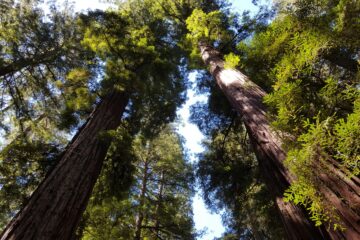
Castle Rock, the namesake outcrop and park’s high point, anchors the main parking lot area, and Goat Rock is the other famous formation, with Varian Peak and Russell Point rounding out the landmarks. A good Castle Rock State Park guide has to start here because the formations are not a side attraction; they are the trail destinations, the climbing walls, and the viewpoints all at once. Redwood, Douglas-fir, oak, and madrone forest alternates with open chaparral.
Rock Climbing and Bouldering at Castle Rock
Climbers have scaled the Vaqueros sandstone here for nearly a century, and the park remains one of the Bay Area best-known bouldering destinations, with problems from beginner boulders to expert lines. Any Castle Rock State Park guide to climbing has to start with where to go and the rules that protect the rock.
Most climbing concentrates near the main parking lot: Castle Rock itself, Goat Rock, and the popular Magoo Boulders, a short walk along the Castle Rock Trail. Magoo suits newer boulderers, while Goat Rock suits climbers wanting longer routes. Stay on trails between climbing areas and check the trailhead boards for closures.
The single most important rule in this Castle Rock State Park guide is the wet-rock rule. Vaqueros sandstone becomes much more fragile when damp, and holds can break off permanently if climbed while wet. Any measurable rain at the Kirkwood office can close climbing for up to three days, and the park advises waiting two or three days after heavy rain, or until the rocks are completely dry. Treat a rainy weekend as a hiking weekend, and check the official rock climbing information for Castle Rock for current climbing status before driving up. Other rules are straightforward: do not chip, glue, or alter the rock; new bolts require park approval; climbing is not permitted in the San Lorenzo Headwaters Natural Preserve; and climbing classes require advance permits and insurance.
Ridge Hikes in This Castle Rock State Park Guide
The trails are rugged, with real elevation change, uneven footing, and rock scrambling, so pack sturdy shoes, water, and sun protection. There is no water refill guarantee on the trails. The official hiking information for Castle Rock lists the main routes with distances and elevation gains; confirm current trail status there.
The classic hike is the 5.6-mile Saratoga Gap and Ridge Trail Loop, which leads to Goat Rock, Castle Rock Falls, and Russell Point Overlook. The Saratoga Gap Trail drops toward the falls, then the Ridge Trail climbs back along the open ridge. The loop is moderately difficult, and most hikers take three to four hours. This Castle Rock State Park guide recommends it as the first hike for most visitors because it packs the falls, the formations, and the ridge views into one half-day loop.
Shorter options include the 5.15-mile Ridge and Trail Camp Loop (1,190 feet of gain) and the 6.1-mile Skyline, Loghry Woods, and Saratoga Gap Loop (750 feet). Longer days include the 9-mile Middle of the Park from the Gap Loop (1,530 feet) and the 16.4-mile Gap to Gap Loop (1,860 feet), for strong hikers only.
The Saratoga Gap Trail, a nearly two-mile trail dedicated as part of the Bay Area Ridge Trail, parallels Skyline Boulevard and connects with trails to Sanborn County Park, Castle Rock, and Big Basin, plus Long Ridge, Skyline Ridge, and Monte Bello preserves. The Saratoga Gap Trail page from Midpeninsula Regional Open Space District describes the route through weathered oaks and Douglas-fir forest. Hikers using this Castle Rock State Park guide to build longer ridge walks should plan carefully: distances add up quickly, and without cell reception, an offline map is essential.
Castle Rock Falls: A Seasonal Waterfall Worth Timing
Castle Rock Falls drops about 75 feet toward the San Lorenzo River and is one of the most photographed features in the park, but it is seasonal: flow depends on rainfall, so the falls run strongest in late winter and spring and can slow to a trickle or go dry in late summer and fall. Spring is the best bet for a full cascade. Timing matters, and this Castle Rock State Park guide puts spring first.
The Saratoga Gap Trail descends gently through the forest toward a viewing area. The trail is uneven, with roots, rocks, and scrambling near the creek, so stay on the trail and use the viewing platform rather than scrambling to the base, where the rocks are slippery.
The Skyline-to-the-Sea Trail: Castle Rock to the Ocean
For backpackers, this Castle Rock State Park guide begins at the eastern gateway to a celebrated Bay Area long trail. The 33-mile Skyline-to-the-Sea Trail connects Castle Rock and Big Basin Redwoods State Parks, descending from the crest to Waddell Beach. From the main lot or a drop-off at Saratoga Gap, the route runs 25.2 to 28.2 miles, typically two to four days. Castle Rock Trail Camp lies 2.6 miles from the main lot, and Waterman Gap 6.3 miles from Saratoga Gap. Reservations are required, so book well ahead.
The 2020 CZU Lightning Complex fires damaged much of the route through Big Basin, and sections of the lower trail have had extended closures and phased reopening, so confirm the current status on the official Big Basin Redwoods State Park page before committing to dates or campsite reservations. For more long-distance ideas, see this roundup of the best weekend hikes in Northern California.
When to Go to Castle Rock State Park
Castle Rock is open year-round, and this Castle Rock State Park guide rates spring as the best all-around season, with flowing falls, wildflowers, and mild temperatures. Fall brings clear air and fewer crowds. Summer mornings are pleasant, but exposed ridges get hot by afternoon, so start early and carry water. Winter offers solitude and strong flows after rain, but trails get muddy and climbing closes after measurable rain.
Weekends fill the main lot early, especially in spring, so arrive early and carpool when possible. With no cell reception, tell someone the planned route and expected return time before heading out.
Practical Info for Visiting Castle Rock State Park
A little preparation goes a long way at Castle Rock, and this Castle Rock State Park guide gathers the day-of details here. Parking is in the main lot on Skyline Boulevard, at the Kirkwood entrance. A vehicle day-use fee applies, and amounts and payment methods can change, so check current fees on the official park page before the visit. Day use runs 6 a.m. to sunset; confirm current hours before driving up. There are no food or supply sales in the park, so bring water, snacks, and layers.
Drones are not allowed, smoking is prohibited, and fires are permitted only in fire rings at Castle Rock Trail Camp during the rainy season. Natural and cultural features are protected by law: do not pick wildflowers or mushrooms, remove rocks or plants, or deface formations. Camping is limited to designated trail camps by reservation. Castle Rock Trail Camp has picnic tables, pit toilets, water, and a rain shelter; confirm water availability and reservations on the official park page. After a Castle Rock hike, the Half Moon Bay guide covers beaches and small-town stops to the north, and the San Jose travel guide covers planning a South Bay base.
Frequently Asked Questions
Is Castle Rock State Park good for beginner climbers?
Yes, with preparation. The boulders near the main lot, including the Magoo area, hold easier problems for newer boulderers, but bring a crash pad, climb with a partner, and follow the wet-rock rule.
Can I bring my dog to Castle Rock State Park?
No, except for service animals. Nearby Sanborn County Park allows dogs on leash.
When is the best time to see Castle Rock Falls?
Late winter and spring, when flow is strongest. In late summer and fall, the falls can slow to a trickle or go dry.
Can I use this Castle Rock State Park guide to plan a Skyline-to-the-Sea trip?
Yes, as a starting point: it covers the trailheads, the trail camps, and the need to check current Big Basin conditions after the CZU fires, but confirm reservations and the full route status on the official park pages first.
Is there cell service at Castle Rock State Park?
No. There is no cell reception in the park or the surrounding area, so download offline maps and arrange rides before arriving. Ridesharing is not recommended.
Conclusion
Castle Rock State Park packs unusual variety into one ridge-top park: honeycombed sandstone, Bay Area bouldering, demanding ridge hikes, a seasonal waterfall, and a trail to the Pacific Ocean. The park asks a little more of visitors than a typical day-use stop, with winding roads, no cell service, and rules that protect fragile sandstone, but that keeps it feeling wild and uncrowded on a weekday morning. Use this Castle Rock State Park guide to pick the right loop, time the falls, and respect the wet-rock rule.